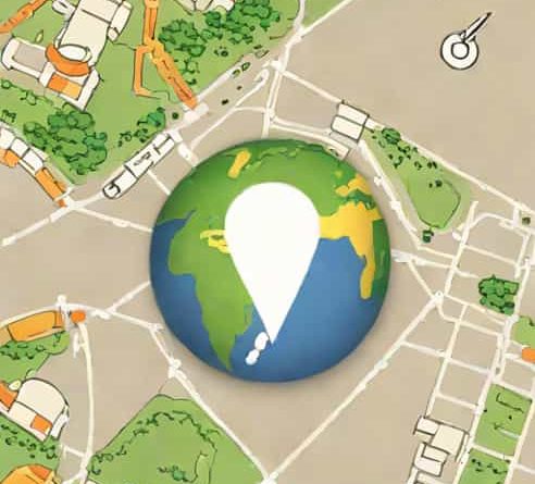
Is Google Earth Live
Google Earth has revolutionized the way people explore our planet, offering a detailed, interactive map experience that allows users to view landscapes, cities, and natural formations from virtually any angle. Many people wonder if Google Earth provides live images, enabling real-time observation of locations around the world. Understanding how Google Earth works, the sources of its imagery, and the distinction between live feeds and updated satellite images is crucial to answering this question. While the platform gives an incredible sense of immediacy, it does not provide live streaming of the Earth in real time in the way a live webcam might.
How Google Earth Works
Google Earth uses satellite imagery, aerial photography, and geographic data to create a three-dimensional representation of the Earth. The platform aggregates images from multiple sources, including satellites operated by government agencies, commercial satellites, and high-resolution aerial surveys. These images are then stitched together and updated periodically to create the detailed maps and 3D models that users interact with. The technology behind Google Earth allows users to zoom in and out, rotate the globe, and explore terrain in ways that were impossible with traditional maps.
Sources of Google Earth Imagery
- SatellitesHigh-resolution satellites capture images of the Earth’s surface, which are used for mapping cities, landscapes, and geographic features.
- Aerial PhotographyAircraft equipped with cameras provide detailed images of regions, often used for urban areas or points of interest.
- Street ViewGoogle’s Street View cars and trekkers collect ground-level imagery, allowing users to explore streets, parks, and other locations in 360 degrees.
- Third-Party DataGoogle also integrates imagery and mapping data from various governmental and commercial sources to improve coverage and accuracy.
Is Google Earth Live?
The term live usually refers to images or video feeds that are transmitted in real time. Google Earth does not operate in this manner. The satellite and aerial images displayed on the platform are pre-recorded and processed before being uploaded. Updates to these images may occur monthly, annually, or on varying schedules depending on the location. Urban areas and regions of high interest are updated more frequently than remote or less populated areas. Therefore, while Google Earth gives a current view of the planet, it is not live in the sense of showing events as they happen.
Frequency of Updates
- Major cities and urban centers Images may be updated every few months to a year.
- Remote or rural areas Updates may occur every few years, depending on satellite passes and availability of data.
- Natural disasters or significant events Google Earth may integrate updated imagery after floods, wildfires, or other events to provide recent views.
Live Features in Google Earth
Although Google Earth itself does not offer live satellite feeds, there are features that provide real-time or near-real-time experiences. For example, Google Earth integrates live weather layers, flight tracking, and real-time traffic conditions in certain areas. These layers use data streams from third-party providers and sensors rather than live imagery of the landscape. These tools give users a sense of current conditions without requiring actual live satellite footage.
Examples of Near-Real-Time Data
- Weather LayersDisplay real-time cloud coverage, storms, and precipitation.
- Flight TrackingShows the current positions of airplanes using live flight data.
- Traffic DataReal-time information on traffic congestion and road conditions in selected regions.
Limitations of Google Earth Live Imagery
Even if Google had the capability to provide real-time satellite footage, several limitations would prevent it from functioning as a truly live service for everyone. First, satellite imagery is subject to orbital paths and cannot continuously cover the entire Earth simultaneously. Weather conditions, such as cloud cover, can obscure the surface from view. Second, high-resolution satellite imagery requires significant processing and storage, which makes instant live streaming at a global scale impractical. Finally, privacy and security concerns would arise if high-resolution live images of populated areas were made available publicly.
Challenges in Providing Live Earth Images
- Satellite orbit limitations restrict continuous coverage of specific regions.
- Cloud cover and atmospheric conditions can obscure satellite images.
- Data processing for high-resolution imagery takes time, preventing real-time display.
- Privacy and security concerns limit access to high-resolution live feeds over populated areas.
Alternatives for Live Observation
For users who want to view live events or real-time images of specific locations, there are alternative options outside Google Earth. Webcams positioned in cities, landmarks, and natural areas can provide live streaming. Additionally, live satellite feeds are sometimes available through governmental agencies such as NASA or the European Space Agency, although these feeds are often limited to meteorological or environmental purposes rather than detailed urban imagery.
Live Observation Options
- City or landmark webcams Provide live views of streets, parks, or tourist sites.
- Weather satellites Offer near-real-time images of cloud formations and storms.
- Earth observation platforms Some agencies provide updated imagery for research, agriculture, and environmental monitoring.
In summary, Google Earth is not live in the traditional sense of showing real-time images of the Earth. The platform relies on satellite and aerial imagery that is periodically updated to provide detailed, accurate, and immersive views of our planet. While Google Earth includes features such as weather, flight tracking, and traffic layers that display real-time data, these are not live images of the terrain itself. Understanding the difference between live data streams and updated imagery is essential for users who expect real-time observation. Despite not being live, Google Earth remains an incredibly powerful tool for exploring the Earth, studying geography, and visualizing locations with remarkable detail and clarity. For truly live views, users may need to rely on specialized webcams or satellite feeds provided by research agencies, but Google Earth continues to offer one of the most comprehensive virtual experiences of our planet.